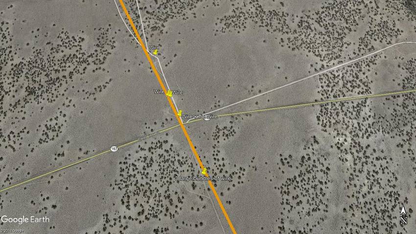
Here's an overhead view of what we found and where we found it. The orange line is the road from Aurora to Candelaria traced from a 1915 USGS topo map (the earliest accurate map I could find). Download the KMZ here: https://drive.google.com/file/d/1HMHXcN5tFx1LMr8aiImYwgF1A75qbpMr/view?usp=sharing |