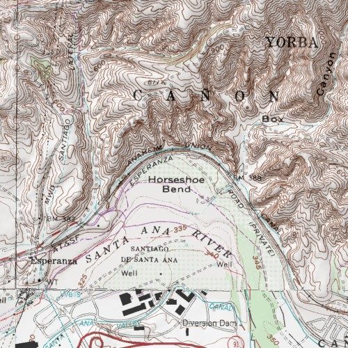
Location of Horseshoe Bend, Orange Co. - Original Source of CGI Sand
By Colin Jung; posted January 26, 2016
View Original: Click to zoom, then click to magnify (500 x 500) 112KB

|
Bob Stahr was kind enough to provide this map excerpt image of the original source of sand used by the California Glass Insulator Company in 1912. Map appears to be a USGS Topo Map. Here are Bob's comments: Horseshoe Bend is a physical feature (bend) in Orange County. This occurs where the Santa Ana river bends near Yorba Linda Blvd. & Riverside Freeway California Rt. 91. Note the location of the A.T. & S.F. railroad line which would have been a very convenient means to transport the sand to the factory. Sand could have been transported by barge as well as both the sand source and factory were near rivers, but I suspect that route and means were much less convenient. Thanks Bob! |