Sightseein' the Transbay Transit Center Construction Site 1
By Colin Jung; posted June 17, 2013
View Original (557 x 429) 141KB
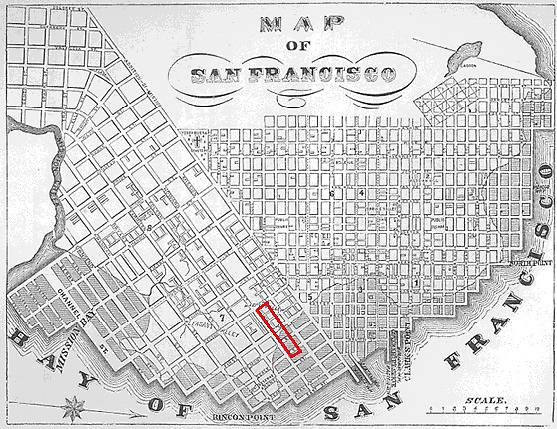 |
Here is a low res 1855 map of San Francisco. I have highlighted in red what I believe is the location of the Transbay Transit Center Project Area. The location is somewhat uncertain as I can barely read some of the street names. The dotted line depicts the original bayside coast line for San Francisco. All of the shaded areas are portions of San Francisco Bay that were filled in to create more land. Notice that half of the project site is on fill. |